ENV 310: SOIL INFORMATION SYSTEMS | SESSION 1, 2010
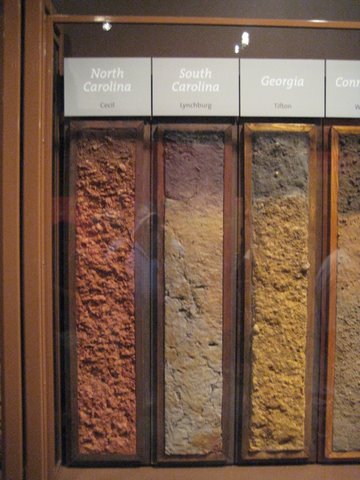
| Smithsonian Soils Exhibition (2008). Photo of soil monoliths from North Carolina, South Carolina, and Georgia. |
| Welcome |
This course is designed for the undergraduate and graduate students interested in Soil Information Systems (SIS) and its applications in various fields, such as forestry, wildlife and fisheries biology, landscape design, geology, real estate and others. Soil Information Systems include input, storage, analysis and output of soil information through the use of Geographic Information Technologies (GPS, direct/remote sensing, GIS) and Soil Data Systems (soil survey, laboratory data and soil data storage). Course is based on lectures and computer, laboratory, and field excercises. |